The shortest path between two starting points can be identified with the Trace tool using the Shortest path trace type. The shortest path is calculated using a numeric network attribute such as shape length. Cost- or distance-based paths can be achieved with a shortest path trace.
To learn more, see Utility network trace types.
Requirements
To perform a shortest path trace, the following requirements must be met:
- Two starting points must be placed on network features.
- The network topology must be enabled.
- When working with an enterprise geodatabase, the Input Utility Network parameter must be from a utility network service.
Trace the shortest path
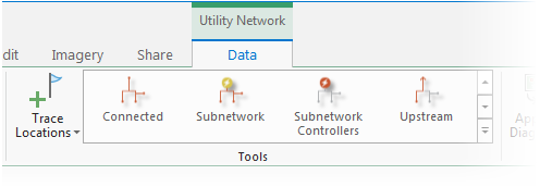
- Ensure the utility network is available in an active map view and click the Data tab under Utility Network on the ribbon.
The Utility Network Data tab is activated.
- Ensure that two starting points exist. Within the Tools group, click the Trace Locations command to open the Trace Locations pane. Set two Starting Points to use in the trace.
- In the Tools group, click Shortest Path from the tools gallery. This will open the Trace tool for the utility network in the active map using a shortest path Trace Type.

Tip:
Use the down arrow to browse within the tools gallery for Shortest Path.
- Specify a Shortest Path Network Attribute Name to be used to calculate the shortest path or cost of travel between the two starting points. Use a numeric network attribute such as Shape length.
- Apply additional configuration parameters as needed. Reference the Trace tool for a full list of tool parameters. Also see Configure a trace.
- Click Run.
Features participating in the shortest path between the two starting points are returned.