ArcGIS Pro has a variety of utility network tools to help you create, configure, and work with your utility network system. You can access utility network tools and commands, network properties, and dirty areas through the utility network layer. This topic will help you get started working with a utility network and become familiar with its suite of functionality.
Note:
If you are unfamiliar with any of the terminology used here, see Utility network vocabulary for more information.
Create and configure the utility network
Before creating and configuring a utility network, it is important to understand the differences in deployment types and options for configuration. The geodatabase type that stores the utility network will determine the type of deployment, or vice versa. This will impact the configuration, sharing, and licensing of the utility network. You can create and configure a utility network manually by using core tools or using the Utility Network Package Tools to automate the process. After the initial implementation, you can use these same tools to modify the configuration based on changes in the data model.
For more information about creating and configuring a utility network, see Utility network creation and configuration.
Utility network dataset and layer
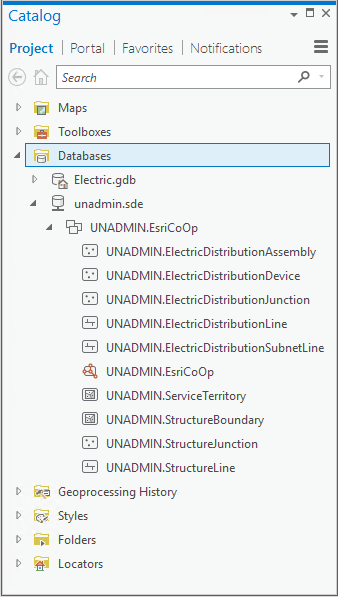
When a utility network is created, a utility network dataset is generated with the name specified. This name represents part of the fully qualified name for the utility network when viewed in the Catalog pane.
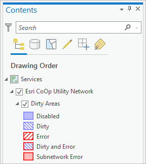
When added to an active map, the layer provides access to the Utility Network Data tab, network properties, and dirty areas. The layer name shown in the Contents pane is the utility network name + Utility Network. For example, EsriCoOp Utility Network.
Learn more about the utility network layer


Utility Network Data tab
Under the Utility Network tab, the Data tab becomes available when you add a utility network to a map. This tab contains tools and commands that are most commonly used in utility network workflows.
There are a variety of tools and commands under the Utility Network tab, on the Data, tab that allow you to work with the network topology, associations, tracing, and network diagrams, and perform subnetwork management tasks.

Learn more about the Utility Network tab
The Data tab includes commands to create new network diagrams, find existing diagrams, and overwrite or append features to opened diagrams. The more specific network diagrams, commands, and tools are grouped on the Network Diagram tab. This is a contextual tab that becomes available when you create a new diagram or open an existing diagram.

Utility Network toolbox
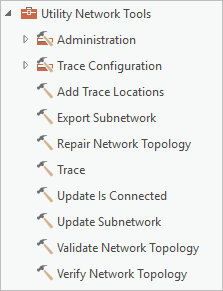
The Utility Network toolbox contains a number of tools that can be used to create and manage the utility network for individual use, modeling, and scripting purposes. These tools can be accessed via the Analysis tab in the Geoprocessing group. Some of the same operations available using the geoprocessing tools can also be accessed from the Utility Network Data and Network Diagram tabs as described previously.
