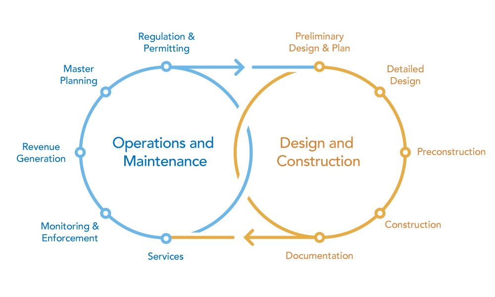
Building scene layers allow you to store, distribute, and analyze detailed information from construction documentation in ArcGIS. Designers, builders, and owners generate many kinds of information about buildings throughout the life-span of the building. You can use the building scene layer to capture the geometry, semantic organization, and attributes in 3D construction data for use with other GIS content.

GIS and BIM workflow
You can use building scene layers for many purposes, from quick visualization of a building in its real-world context to data-intensive workflows that connect individual assets in the layer to complex enterprise processes. The use of building scene layer information may require planning and specific workflows to maintain information.
GIS can facilitate aspects of BIM by bringing information from sources together and providing detailed analysis and search capabilities. The subsections below provide examples of using GIS in a BIM process.
Document construction phase
Though GIS is most often used after the construction phase during the operational life of a building, it can help you view building models and construction progress. For example, visualizing the construction site in the context of the surrounding area can help contractors learn about buildings, streets, and street furniture that may impact delivery of construction material.
To optimize communication and keep stakeholders engaged, you can share the construction site as a web scene and regularly update the building under construction.
Space management
BIM can improve efficient and cost-effective use of space in a building. You can connect room information to other systems to monitor room capacity, for example.
You can also visually analyze the space management and monitor space use by applying different symbology for each usage type. Analyzing and querying space information in building scene layers allow you to plan for building refurbishment such as changing floor plans or meeting and quiet spaces and to communicate these changes with your audience.
Asset management
During the operational life of a building, you must manage building assets. For example, building information model data can help you plan and execute regular inspections by storing and leveraging the information about the maintenance procedures and operation and maintenance manuals. This can also help you respond to unplanned maintenance to keep assets in a safe, efficient, and cost-effective state.
Environmental analysis
A building must be seen in the context of its environment. The surrounding area influences the building. For example, other buildings may cast a shadow onto the building, causing additional need for lighting in the building section. Also, the view from the building may be blocked by others, and you may need to rebalance the heating, ventilation, and air conditioning system or the price of the units from the real-estate perspective.
You can also perform other types of analysis in GIS, such as for flood damage, solar radiation, or distribution of hazardous substances in the air of rooms that are in contact with the ground on which the building is constructed. In these cases, you can use geoprocessing or interactive analysis to explore the environment surrounding the building.