Available with ArcGIS Maritime license.
You can load the Electronic Navigational Chart (ENC) or Inland Electronic Navigational Chart (IENC) XML workspace into an enterprise geodatabase to create the Nautical Information System (NIS). The XML files are preconfigured and available with ArcGIS Maritime; they contain all the necessary feature classes and tables that can be used to manage the NIS.
Versioning is required for a multiuser environment. Archiving is optional and suggested for historical traceability.
The XML workspaces include the following:
- Nautical feature dataset
- Three feature classes that store the deleted features
- A ClosingLinesL feature class that can be used to generate depth areas
- Collections and tables, including FREL tables that store spatial relationship information
Register the following objects as versioned and enable archiving:
| Object type | Name |
|---|---|
Dataset | Nautical feature dataset |
Feature classes |
|
Tables |
|
- Start ArcGIS Pro.
- If the Catalog pane is not already open, on the View tab,
click Catalog Pane
 .
. - Expand Databases and double-click an NIS enterprise geodatabase to connect to it.
- Expand the geodatabase to access its feature classes and tables.
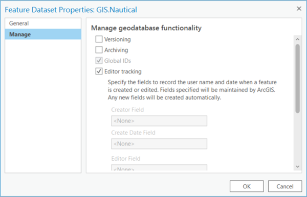
- Right-click the Nautical feature dataset and click Manage.
The properties dialog box appears with the Manage tab active.

- Check the Versioning check box and set it to Traditional.
- Check the Archiving check box.
- Click OK.
- Repeat steps 5 through 8 for each feature class and table listed above.