A voxel layer represents multidimensional spatial and temporal information in a 3D volumetric visualization. For example, you can visualize atmospheric or oceanic data, a geological underground model, or space-time cubes as voxel layers. Access to volumetric data about the world provides higher-accuracy analysis and a better understanding of conditions that you can't physically experience. Use voxel layers to explore spatial relationships with other content. For example, an underground model visualized as a voxel layer can be viewed together with boreholes or construction that is planned in an area.
Voxel layer capabilities
Voxel layers are based on volumetric data stored in a netCDF file in ArcGIS Pro. You can create a netCDF file from a geostatistical layer or use a space-time cube with data aggregated into fishnet or from other sources. See Create a voxel layer for detailed workflows on voxel layer creation.
When adding a voxel layer to a local scene, you can choose the variable to draw by default, the variables you want to make available, and whether the data represents continuous or discrete data. A voxel layer can have multiple variables. You can identify variables for a particular voxel cube. You can configure pop-ups to define the variables you want to display in the pop-up.
Note:
If the layer's data source is netCDF and the layer has Optimized for performance disabled, the pop-up only displays values for the current variable.
When exploring 3D volumetric information, it is important that data is not distorted. Consequently, the voxel layer can only be added to a local scene with the same coordinate system. If a voxel layer is added to a global scene or map, the voxel layer is unavailable in the Contents pane and will not draw. To view multidimensional data in a map or a 2D layer of a scene, use a multidimensional raster layer.
Voxel layers often cover large areas. There are various capabilities you can use to explore the voxel layer in detail. Voxel layers can be visualized as volumes or surfaces. You can define an area of interest using slices to view the volume for a specific area rather than the entire dataset.
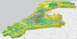
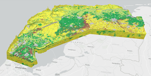
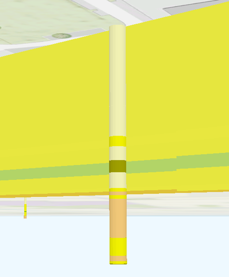
You can explore the surfaces of a voxel layer. You can create sections to understand structures in the voxel layer. For example, you can create a cross section diagram to explore an underground model at locations where new construction is planned. You can show a voxel layer together with other GIS content. For example, to show the impact of the underground model to a construction area, measure the thickness of a geological formation or show the underground model together with boreholes.
When a variable is continuous, you can create a surface along a specific value represented as an isosurface. Sections and isosurfaces can be shown together. For example, you can explore a voxel layer by creating cross section diagrams, or in the case of quantitative data, isosurfaces.
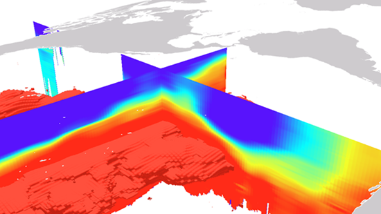
You can compare information recorded in variables for an individual voxel cube. To explore variables together, you can lock sections to create a snapshot for a variable and examine it together with isosurfaces of another variable. For example, you can explore the relationship between water temperature and oxygen level. Create locked sections showing a temperature cross section diagram and create isosurfaces of different oxygen levels to see the spatial relationship between the two variables.
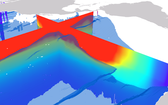
A voxel layer can include time information for each variable, allowing you to visualize the voxel layer over time. You can create time-based animations and share them as videos.
You can use lighting options, such as illumination of the scene or the lighting options on the voxel layer to change the visual appearance. You can enable time when adding a voxel layer. You can identify individual voxel cubes represented as volume, surfaces, or sections and get the current variables' value, unit, and time stamp. You can add a scene with a voxel layer to a layout and share it or export the scene to a file directly. The number of legend items depends on the variables you show and whether you have additional locked sections from other variables in the voxel layer.
Voxel layer structure
The voxel layer is structured in dimensional regularly gridded cubes that store one or many variables.
A voxel layer can represent different dimensions.
- X, Y, Z in which each dimension represents a geographic coordinate.
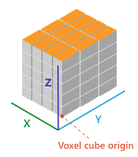
- X, Y, Level in which X and Y represent a geographic coordinate and Level a value, such as isobaric pressure.
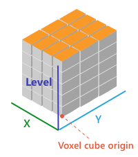
- X, Y, T in which X and Y represent a geographic coordinate and T represents time as a level. An example for this type of dimension is the space-time cube.
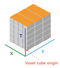
- X, Y, Z ,T in which each dimension represents geographic coordinates and includes a fourth dimension representing time.
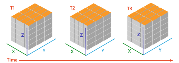
The spacing between the cubes in a voxel layer must be identical but can vary between the different axes. For example, X may be 100 meters, Y may be 50 meters, and Z may be 50 centimeters. The dimensions can be different but must follow the same spacing. Each cube in the voxel layer has one or more variables that represent a value for a voxel cube. For example, a voxel layer may contain variables for salinity and temperature, defined for each voxel cube. Variables can represent quantitative continuous data or qualitative discrete data. Temperature measurements are represented as continuous data. Other data such as lithography classes of an underground model is discrete. Some variables may support empty voxel cubes, which are not shown.
In addition to the dimension and variables, a voxel layer can also contain time information. The voxel layer is time enabled. A special case is the space-time cube in which voxel cubes are stacked vertically by time.
Hardware requirements
Voxel layers use advanced rendering techniques such as ray casting to create high-performing 3D visualizations. Review the ArcGIS Pro system requirements to ensure that your computer meets the recommendations for graphics card memory and that your graphics driver is up to date. To improve the speed or quality of the 3D rendering, you can change the display options to view voxel layers on a computer that has a lower amount of graphics card memory. This way, you can view the volume in a lower resolution but show the sections in high quality.