Available with Image Analyst license.
A digital surface model (DSM) is an elevation model that contains the elevation of the terrain as well as above-ground features such as buildings, vegetation, towers, and other infrastructure. These above-ground features can be removed to produce a bare earth digital elevation model, called a digital terrain model (DTM).
If your elevation raster is a DSM and you want the terrain instead, Pixel Editor can derive the DTM for an area.
This workflow follows these five steps:
- Start a Pixel Editor session.
- Visualize your elevation as a shaded relief.
- Select the region.
- Derive terrain values from your surface model.
- Save your edits.
Start a Pixel Editor session
Pixel Editor can only edit one layer at a time per map view. The contextual layer used to start the Pixel Editor session is the only layer that can be edited in that map view. To edit another layer in the map, you must first close Pixel Editor, select the other layer in the Contents pane, and reopen Pixel Editor to operate on that layer.
- In the Contents pane, highlight the elevation raster dataset layer that you want to edit.
Pixel Editor can only edit raster dataset sources.
- Click the Imagery tab.
- Click the Pixel Editor button
 .
.
You are now able to edit your elevation raster dataset using Pixel Editor.
Visualize your elevation as a shaded relief
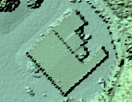
When editing elevation data, sometimes it is easier to work with the shaded relief view of the data, so that you can clearly see both subtle and abrupt changes in elevation. This is especially useful when identifying buildings or other areas where the slope changes.
- Zoom in to the area where you want to remove a building to derive the terrain model. If detailed elevation is difficult to see, we can view the elevation as a shaded relief.

- On the Inspect tab,
click the Shaded relief button
 .
.
Select the region
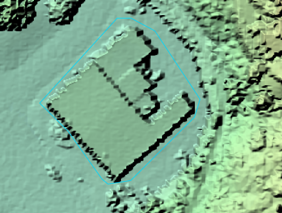
Now that we can clearly see the building we want to remove, we can select it as a region and interpolate the ground values to derive a terrain model.
- On the Pixel Editor tab,
click the drop-down arrow below Region Mode, and choose New
 .
. - Click the drop-down arrow below Region, and choose Polygon
 .
. - Draw a polygon around the building; double-click to end the polygon.

Derive terrain values from your surface model
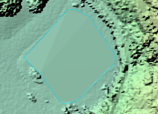
There are a few ways to remove the building to derive the terrain value. In this workflow, we will use the values at the vertices to interpolate the values inside the selected region.
- Click the Operations drop-down menu, and choose Interpolate From Vertices
 from the gallery.
This will open the Pixel Editor Operations pane.
- Make sure that the region you created is selected. If not, click the Select tool
 from the Region group, and select the region.
 - Choose the Interpolation Method to use. For this workflow, choose Linear Tinning.
- Optionally, you can check the Blend check box, so that your region looks more seamless in the raster. Choose a Blend Width of 2 (pixels).
- In the Pixel Editor Operations pane, click Apply. The values from the vertices of the selected region will be used to ground values.

Save your edits
To commit your edits back to the data source, you must save them.
- In the Save group, click the Save button
 .
.To save your edits without affecting the source data, save to a new file. In the Save group, click the Save As button
 , and specify a location and file name for the new file.
 - Click Close Pixel Editor
 in the Close group when you finish editing the raster dataset.