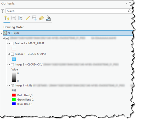
There are several image support data structures that are used to describe how data is organized and how it should be presented in a National Imagery Transmission Format (NITF) file. These data structures are organized into data headers and segments and are further described by several fields or tagged record extensions (TREs).
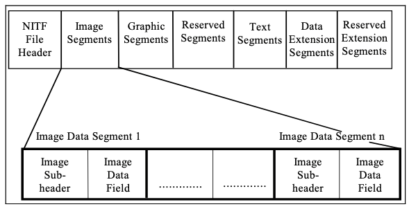
A fundamental goal of NITF is to capture all information needed to support the processing, exploitation, and dissemination of imagery-derived information. To meet that goal, a committee of experts maintains the evolution of NITF through a standards body that works to maintain a highly flexible data model.
As system capabilities have evolved, so too have the data products generated from those systems. The NITF standards have also evolved to keep up with the more modern data products. As a result, there are a variety of NITF data products for all official versions of the NITF standard.
NITF metadata
NITF image support data (ISD) contains contextual information about the data contained in a .nitf file or set of .nitf files. The primary goal of ISD is to provide enough metadata to help guide and portray data products as they were originally intended, without restricting access to the raw data.
Key uses for NITF metadata include general processing history of the data, governance, distribution, and specific parameters used to properly geoposition the relevant contents of any NITF container.
NITF ISD can be accessed several ways in ArcGIS Pro. These include specific image support data tabs on both layer and dataset property dialog boxes, and through the Image Support Data pane.
Properties dialog box
On the Properties dialog box for an NITF layer and NITF dataset, you can explore, search, access, and export NITF ISD through the Image Support Data tab.
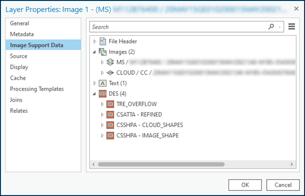
Image Support Data pane
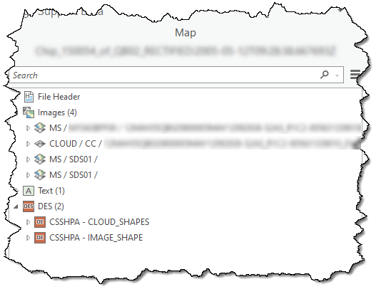
You can also use the Image Support Data pane to explore, search, access, and export NITF ISD.
To access the Image Support Data pane, right-click the NITF layer in the Contents pane, and click Image Support Data. The Image Support Data pane for the layer appears.
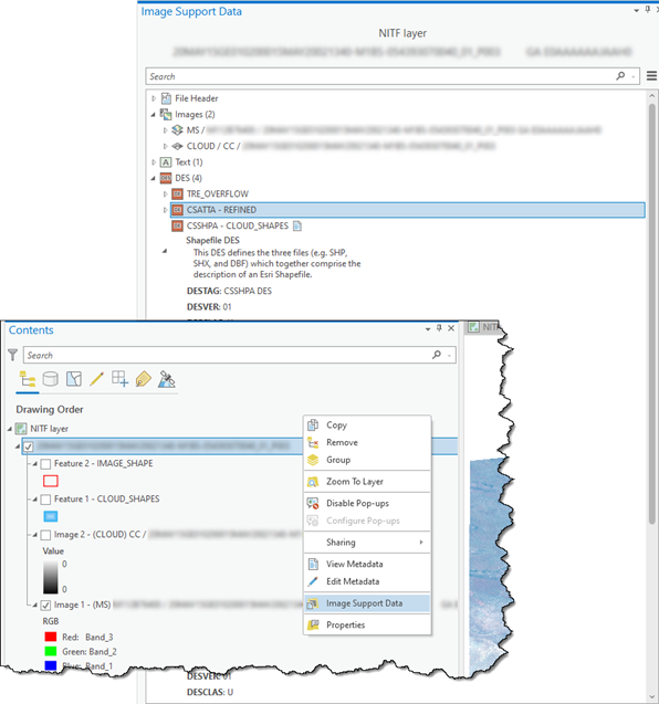
NITF ISD is stored as TREs or data extension segments (DES). Detailed information for a TRE or DES can be accessed by switching the description text associated with the specific TRE or DES of interest from in the main body of the ISD viewer.
Geoposition NITF image sublayers
NITF files can contain multiple sources of map transformation metadata to properly position the imagery with respect to the earth's surface. It is important to know the order and precedence of use to understand the quality of positioning. The application precedence in ArcGIS Pro of the coordinate data in the .nitf file is listed below.
- CSM (Community Sensor Model)—The primary map information for the file. This is used if the CSM is available and the appropriate ISD is present.
- SENSRB—Predominately used for single frame full-motion video (FMV) files if the appropriate ISD is present, such as sensor attitude metadata.
- RPC00A and RPC00B—Rational polynomial coefficient information is used if CSM or SENSRB information is not available.
- GEOSDE—Map information (if available) is imported from MAPLOB, PRJPSB, and GEOPSB TREs, and tie point and pixel sizes are created in the specified projection. If the projection is not supported, this information is considered invalid and the IGEOLO georeferencing method is attempted.
Note:
If available, tie point and pixel size are imported into a geographic coordinate system from the GEOLOB and GEOPSB TREs.
- IGEOLO—The NITF image subheader containing coordinate data. If the coordinate data is valid, the tie point and pixel size are computed for the image. Otherwise, an affine map transformation is used to determine georeferencing for the image.
Note:
IGEOLO coordinates are not considered accurate and are used for approximate location in discovery indexing.
- ICHIPB—Used to perform mensuration and to calculate geopositions of features on image chips.
Note:
Locational tags not currently supported include RSM, ILOC, and BLOCKA.
NITF read
ArcGIS Pro supports reading and managing multiple segment image files. Multiple image segments in an .nitf file contain displayable image information, in which each image segment contains a single image consisting of one or more bands of data.
Multisegment support
ArcGIS Pro supports data access and display of NITF data that contains multiple data segments, sometimes referred to as NITF subdatasets or NITF sublayers. The NITF standard organizes data types into a variety of data segment types as described in What is NITF data.
Depending on the type of data contained in the NITF data, such as image, raster, and shapefiles, a variety of mechanisms are provided to access this information. The Image Support Data pane provides a view into the organization and structure of NITF metadata including access to all the information about each segment.
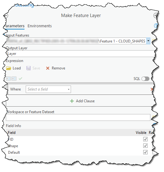
The geoprocessing framework supports NITF subdatasets as input into relevant geoprocessing tools and raster functions through direct use of tools, models, processing chains, or scripts.
The NITF layer provides support for visualizing the contents of multisegment image segments in an .nitf file containing displayable image information. Each image segment contains a single image consisting of one or more bands of data.
